Home
Up
Storm Chase Log - 2003
John and Beth Moore
This is the initial log of our 2003 midwest chase trip. The route map will be added later (I hope).
Wed May 21 - to Las Vegas, NM
We started our chase around noon on May 24, driving to Las Vegas, NM.
Thu May 22 - to Goodland, KS
Activity was possible in NE CO so we drove to Clayton, NM up through Springerville, CO, north almost to I-70, back south a ways, and then up to Goodland for the night. There were storms along the front range but nothing for us to chase.
Fri May 23 - To Guymon, OK
No chasing today. We drove to Guyman, OK to be in position for a faint chance of tornados the next day in the Texas, Panhandle.
Sat May 24 - To Plainview, TX
Remarkable luck! Storms blew up along a boundary south of Canadian, TX. Although winds were marginal for tornados (30kt @ 500mB, 10kt on ground - total 40kt shear), we went no chase it. 500mb winds were from the North, so average storm motion should be to North to South, and supercell to the South-West. Several storms formed along the boundary, and one organized into a supercell.
We just barely made it to Maimi, Tx when we saw a good flat rain free base. We parked next to the coffin-mobile (Matt Crowther, et al) and Cloud Nine Tours when a wall cloud formed. With binoculars, Beth saw it rotating. It then produced a large rotating funnel which lasted a few tens of seconds, reaching partway to the ground (ground was the top of a mesa north of us and higher than our position). Then it retreated. That was the big show!
Dr. John Monteverdi was only 500 yards from where the tornadic circulation from that funnel reached the ground, thus confirming that this was an actual tornado. It all happened too quickly for pictures.
We then chased a bit more in junkus, heard a spotter call in rotation in what was obviously a shelf cloud (sigh) and then we spotted the spotter who was in an ambulance (We shall hence forth refer to this as an ambulance-nado).
Off to Plainview, TX for the night with an eye towards Permian Basin chasing the next day.
Mon May 26 - To Perry, OK
Sigh. No sign of storms into the future except maybe North Dakota. So we started north to visit my dad in Lawrence, KS.
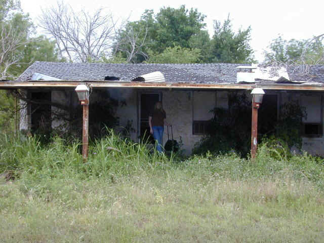
On the way, we checked out the local accomodations. Beth even tried to check in to this one:
Tue May 27 to Lawrence, KS
On the way to Lawrence, we decided to visit Mulvane, Kansas where three of my old college friends and current software colleagues are from:
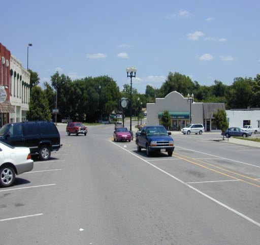
Downtown Mulvane, Kansas.
Wed-Thu May 28-29 - Lawrence, KS - Visiting the Old Homestead
Friday May 30 - Lawrence to SPELUNKING to Garden City, KS
Saturday May 31 - Garden City, KS to Brush, CO
Our cave exploring left us a bit out of position, with the best storms forecast for NW Nebraska. We initially headed for Goodland to intercept the freeway and visit the NWS office there. The folks at NWS were very nice and we got lots of data. On the way back to the freeway, we found ourselves on a wide, empty street. A very nice policemen pointed out (via a warning ticket) that the speed limit was 30mph. All in all, Goodland folk seem to be pretty friendly folks.
We headed into NE Colorado and went after a supercell near Ft. Morgan, but there was nothing but disorganized multicellular junk by the time we got there. Off to the far north we could see a couple of good looking cells going up - out of range giving the approaching sunset. We checked them out on radar, and called Matt, who was already on them (he has a LOT of data sources). He and his crew had started the day farther north, and saw a nice tornado on the northern cell.
Oh well... the cave was worth missing the tornado. We found a motel in Brush, CO and spent the night.
Sunday June 1 - Brush to Liberal, KS - and a Sh*tStorm
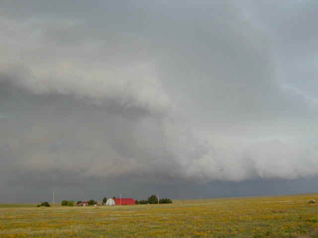
This turned out to be quite an interesting day. Convection started very early - we left the motel and were already too far north! We decided to follow the old rule of going after the southernmost storm, and blasted south down 385 towards a promising looking beast near Cheyenne Wells. Sure enough, a tornado warning came out (it was a landspout NE of Arapahoe). Visibility was poor and we could see neither the tornado nor good cloud structure. At Cheyenne Wells we went east and stopped at a pull-off near Arapahoe. Already there was a black SUV covered with stickers, and with wire widgets which could be put up to protect the windows from hail. Standing next to it was a grinning Warren Faidley (whom it took me a moment to recognize). We said howdy, took a look at the storm which by this time had a distinct arcus (outflow shelf cloud - see picture), took a quick (and not very good) picture, and blasted away in hopes of finding another storm that might still produce a tornado.
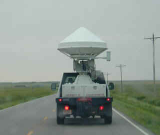
We also spotted a fleet of four research radars heading south:
Unfortunately, the storms behind us formed a bow echo, producing a rapidly advancing shelf cloud which portended very high winds. Still maintaining the fantasy that we might catch a developing cell before it became part of this mess, we headed over to Sharon Springs and then south. Still fleeing, we turned east and tried to bypass Lakin (ended up on a little dirt road). As we were slowly driving along this muddy road, winds in excess of 60 mph hit from the left. I was staring at the computer screen when Beth, who was driving, said:
"Dad! We're being turded!"
Huh?
"Dad! Look at my window!"
Sure enough, her entire window was covered with small bits of black and brown ah... fecal material! You couldn't even see out! It turned out that we within a few feet of a small feedlot, and the high winds were spraying the dung-covered ground all over us! It didn't smell very good, either!
By the time I had the camera out (this will be a familiar refrain), we had passed the lot and the sh*t storm stopped. Then the winds backed down, the rains came, and the car was washed clean. Of course, the odor was with us for quite a few more days!
In any case, we can now say that we have been in a literal shitstorm! How many people can say that!
We drove on to Liberal to spend the night.
Monday June 2 Liberal->Punkin Center->Kim->Clayton
Tuesday June 3 - Last full day of Chasing - Clayton to Hereford Texas, with TORNADOS
Wednesday, June 4 Hereford->Vega->Dalhart->Mosquero->Gallup
An instructive day. We really wanted to be home by Thursday early afternoon, which limited our choices and biased our decision making. We decided to drive up to Vega, on I-40 near the TX-NM border. If anything happened in the right direction, we'd chase it. If not, it was on the road home.
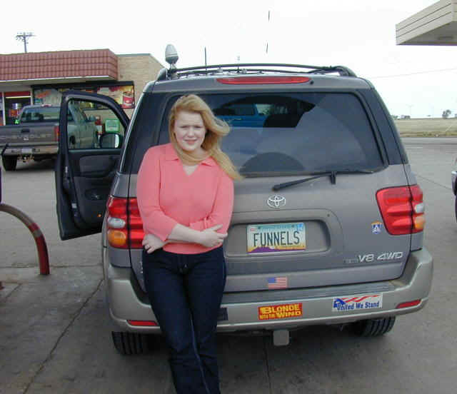
Anyway, first we had to get a picture of Beth with the bumper sticker she had bought at a truck stop ("Blond with the Wind" - appropriate for a storm chaser):
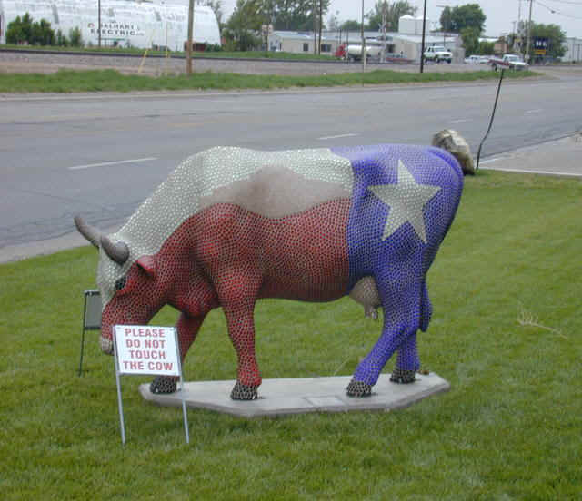
We got to Vega around noon, found the nice little library in an old store front, logged on to the internet, and immediately saw a nice looking supercell a few counties north near Boise City, OK, heading south (these NW flow regimes are odd...). So off we ent to Dalhard. Here we discovered an amazing cow:
Around Dalhart we spent some frustrating time trying to find the right part of the storm... and finally had to flee as it became outflow dominant and chased us out of Texas.
Oh well... the best dew-ponts were supposed to be further west and then south anyway, and there was a tornado warned storm at Springer, New Mexico of all places. Given the road system out there, an intercept was questionable, but we decided to try. Off we went on a tiny, extremely empty road to Mosquero, NM. We did indeed see some storms, but no decent structure. We decided to call the chase and head home, at which point we discovered we had to backtrack all the way to highway 54. We drove until about midnight and stayed at Gallup, NM.
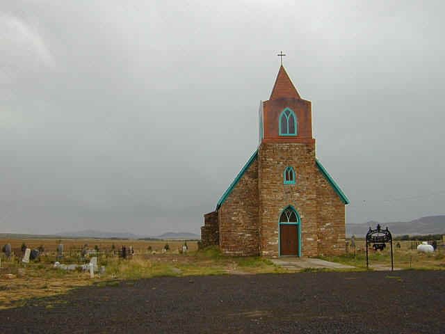
We found this quaint church near Mosquero:
Thursday, June 5 Gallup->Phoenix
A simple drive home from Gallup - taking the Holbrook->Heber->Payson->home route. A few items of note...
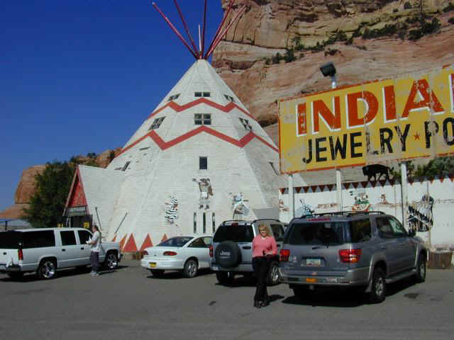
For my whole life I have been driving by the tourist traps along old route 66, now I-40 in this area. Having grown up in New Mexico, there seemed no point in stopping. But this time, we decided to check one out... and get some trinkets for friends.... so here it is:
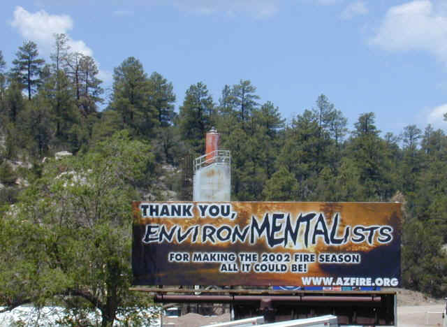
We got stuck for half an hour behind a flagman, a common happening this time of year. When we got near Heber, we wandered around a bit looking at the damage caused by last year's 500,000 acre forest fire. A whole lot of nice Ponderosa Pine forest was gone, along with lots of homes. It was sad... that forest won't return for 100 years! In the town of Heber, which had lost a number of structures, we came across this sign which showed their opinion of the events:
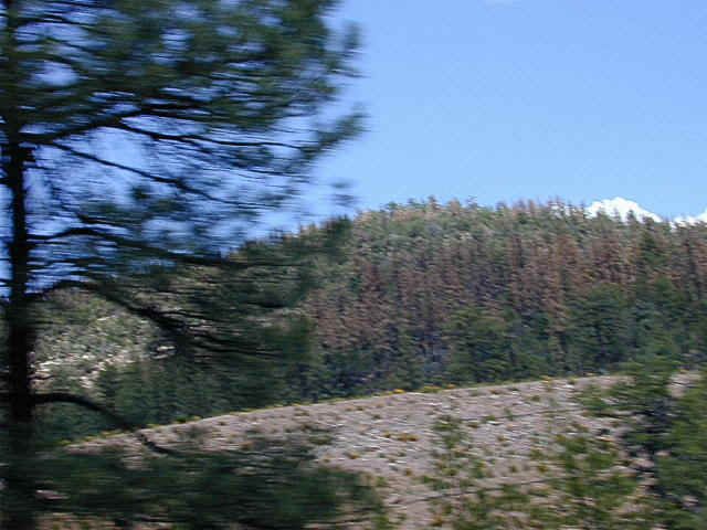
Further down the Mogollon Rim, we came across large areas of forest damaged by bark beetle infestation. The drought has weakened the trees to the point that as many as a third of them are dead in many areas... just standing there forming kindling for the next wildfire. No doubt by the time the environmental impact statements, logging plans, and lawsuits are finished, they will have long ago burned down, taking the rest of the forest with them.
We then drove past about 20 miles of backfired area - the forest on the south side of the road had been burned by the first crews to stop the Rodeo-Chedeski fire. You can see that this controlled burn preserved a lot of trees, but a number are dead, probably from the bark beetles:
The following picture shows the damaged caused by the bark beetles:
Finally we reached the desert, and got home in plenty of time... one more annual trip complete.